

Arctic and Antarctic sea-ice information in February 2026
1. Arctic Sea Ice Conditions in February 2026
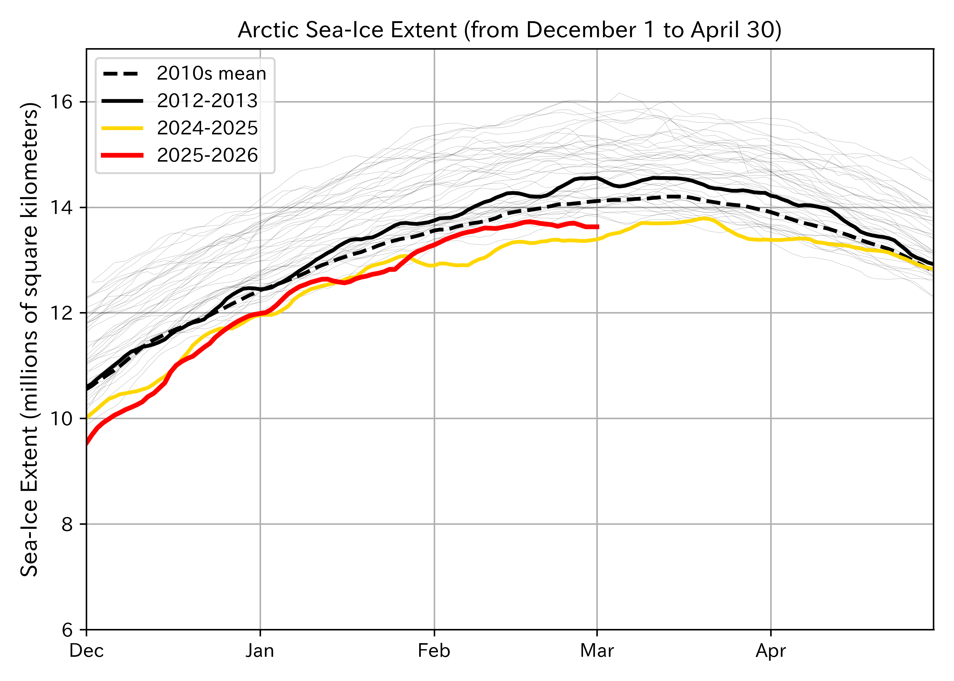
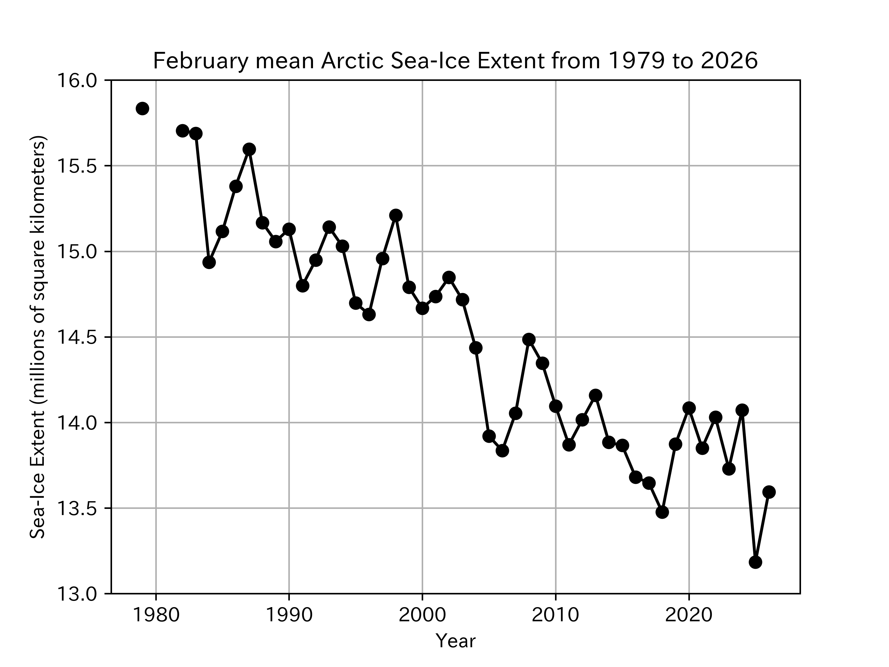
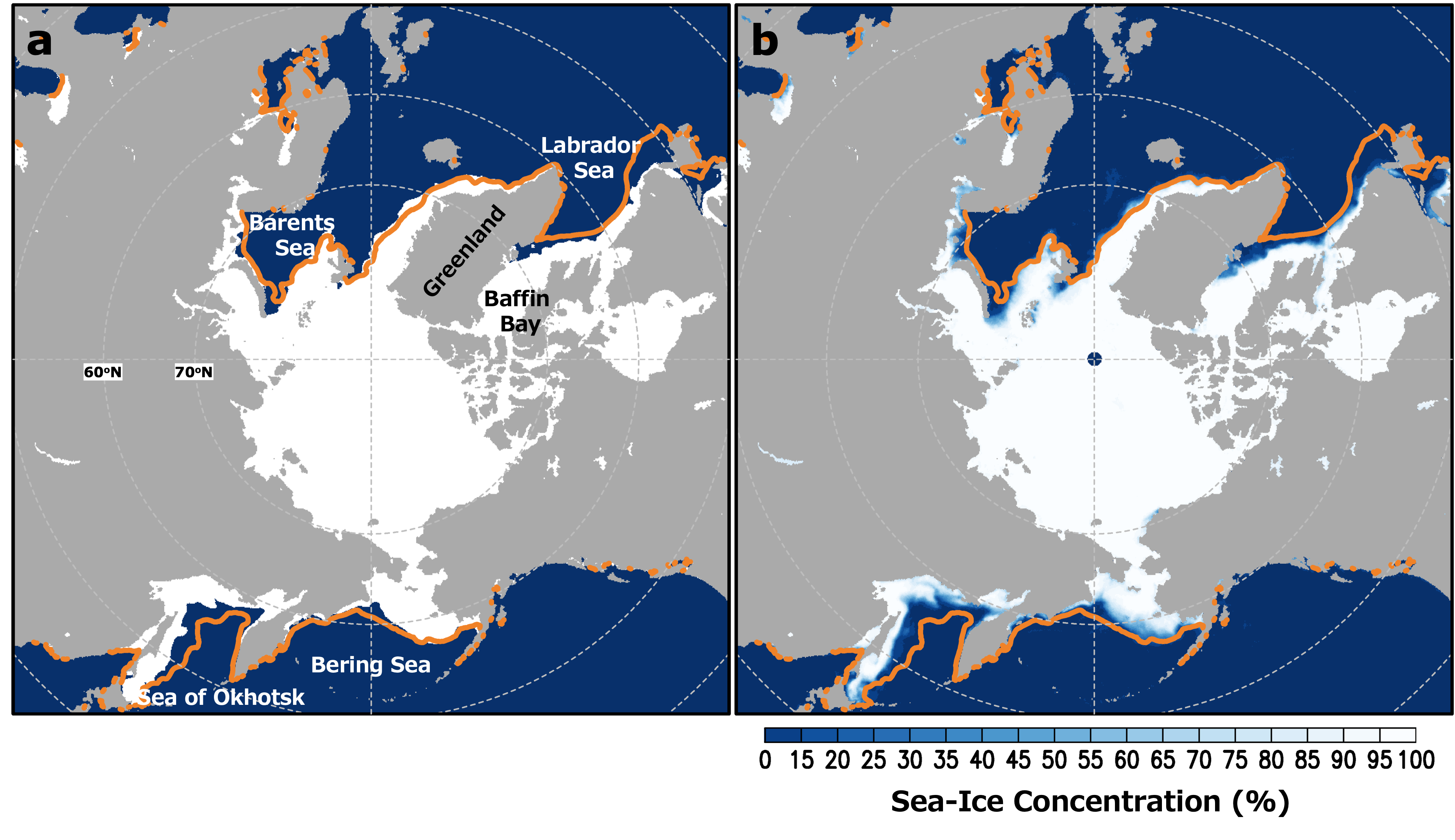
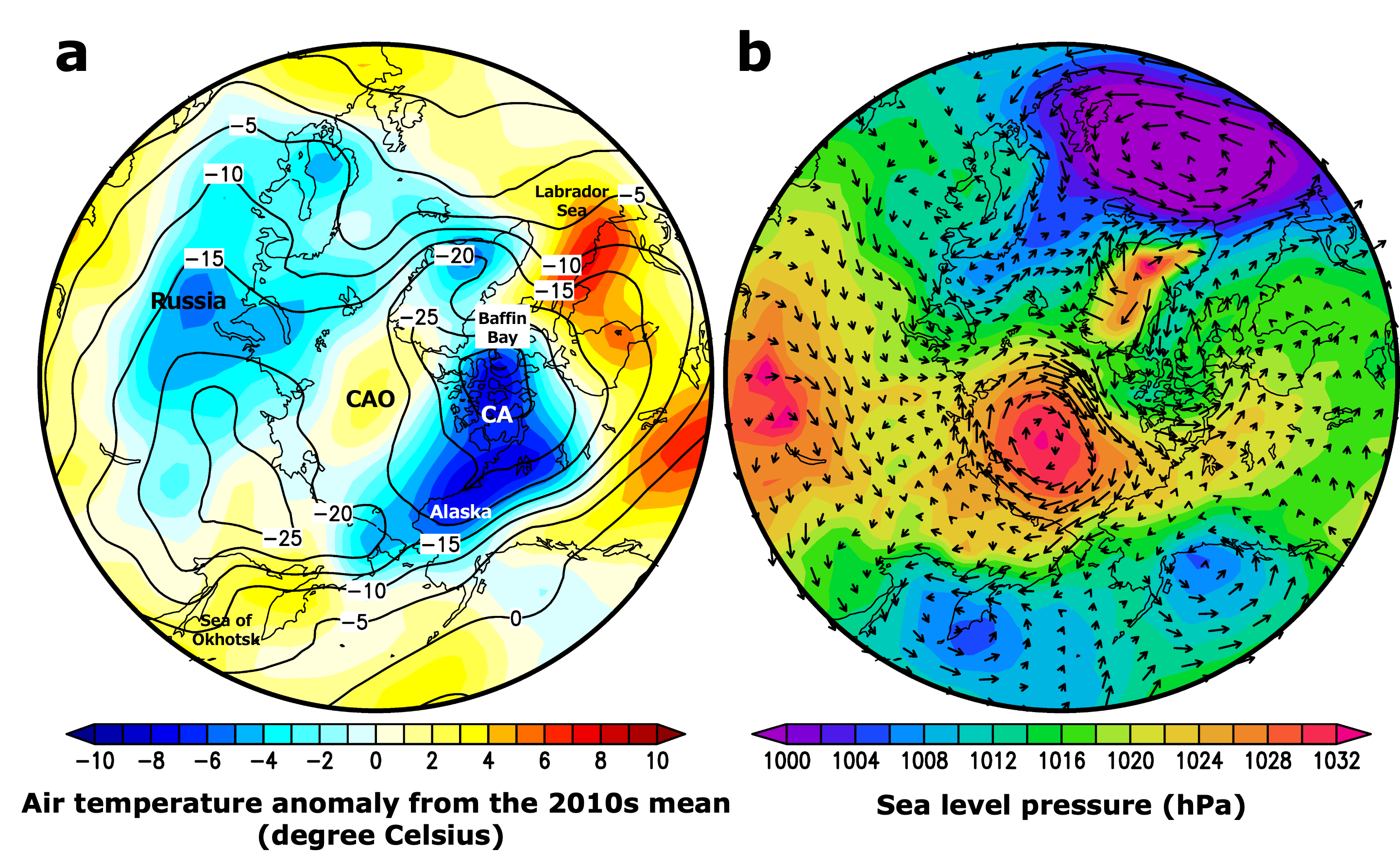
In February 2026, daily Arctic sea-ice extent (note 1) remained low with short-term fluctuations in both increases and decreases (Figure 1). As a result, the monthly mean Arctic sea-ice extent in February 2026 was 13.59 million square kilometers. This is about 0.4 million square kilometers larger than in 2025. However, it is still the third-lowest in the 48-year satellite record since 1979 (Figure 2). Sea-ice concentration was generally high except near the ice edge, and the distribution of sea ice was close to the 2010s mean level, except in the Sea of Okhotsk and Baffin Bay–Labrador Sea regions (Figure 3). In the Baffin Bay–Labrador Sea region, the southward expansion of sea ice was weak, resulting in the second-lowest sea-ice extent in the satellite record. The smaller sea-ice extent in the Sea of Okhotsk and Baffin Bay–Labrador Sea regions is thought to be one of the factors contributing to the relatively small Arctic sea-ice extent. Air temperatures around the Labrador Sea were 3–7°C above average (Figure 4). Similar to the previous month, warm conditions (2–3°C above average) and northeasterly to east winds were observed over the Sea of Okhotsk. By contrast, colder-than-average temperatures persisted over parts of the Canadian Archipelago and Alaska, and extended further into most of Russia. These atmospheric conditions likely contributed to the regional differences in sea-ice extent.
2. Antarctic Sea Ice Conditions in February 2026
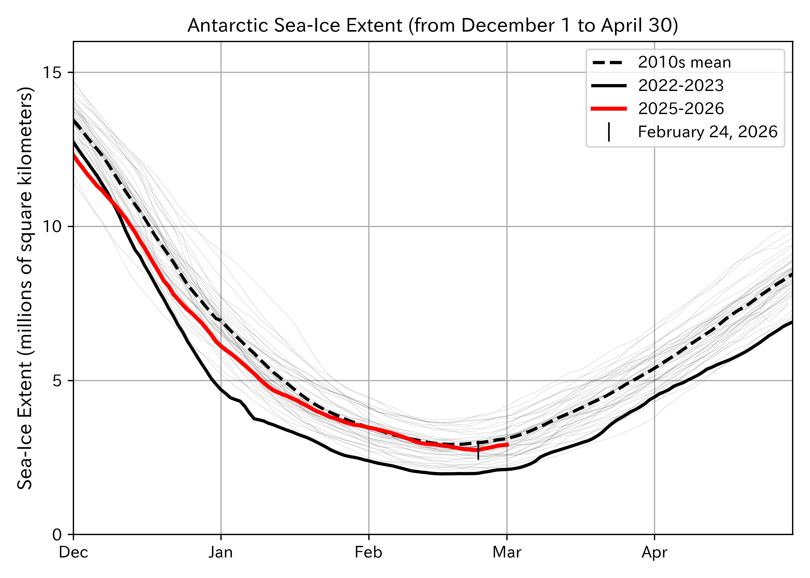
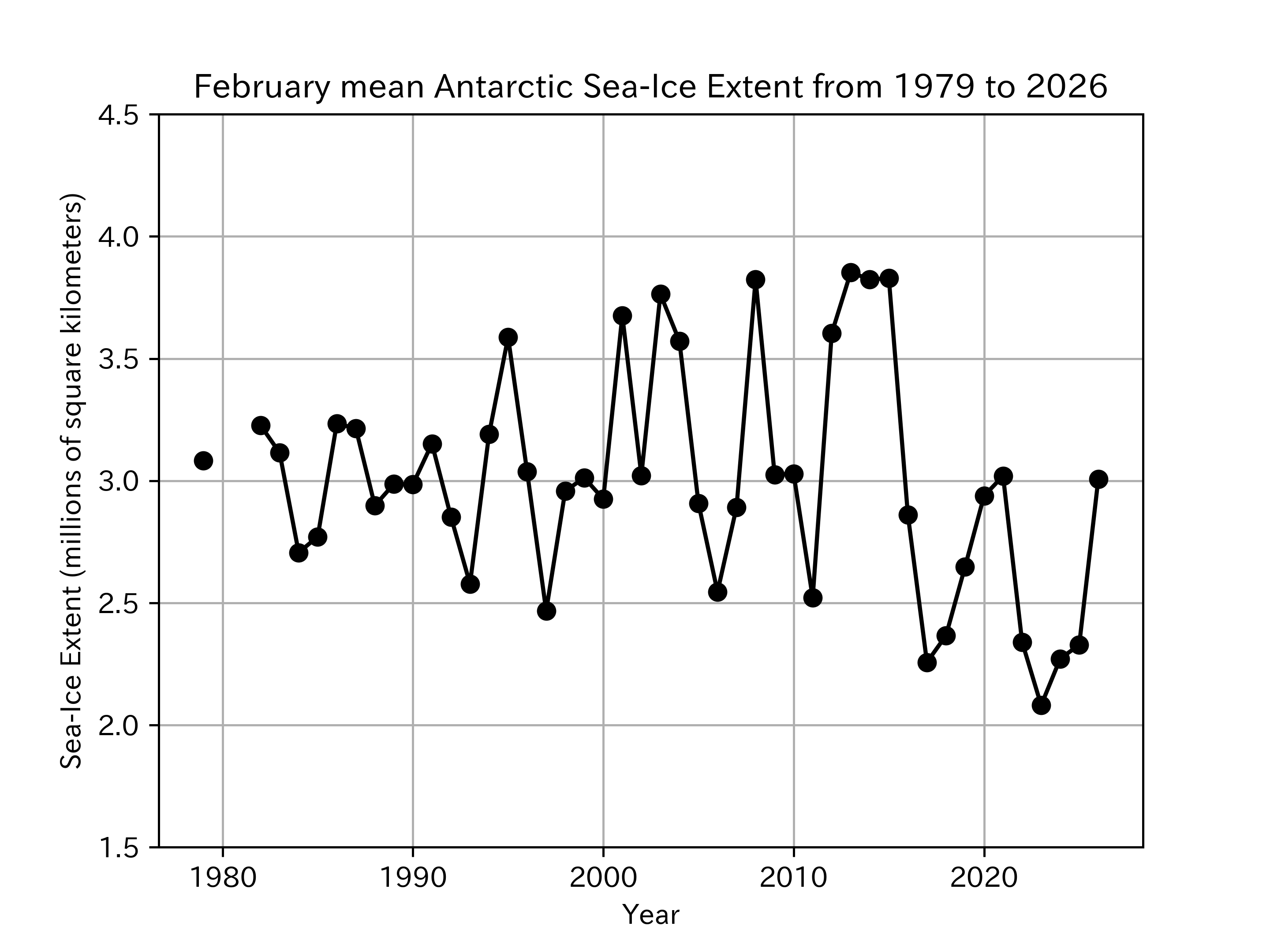
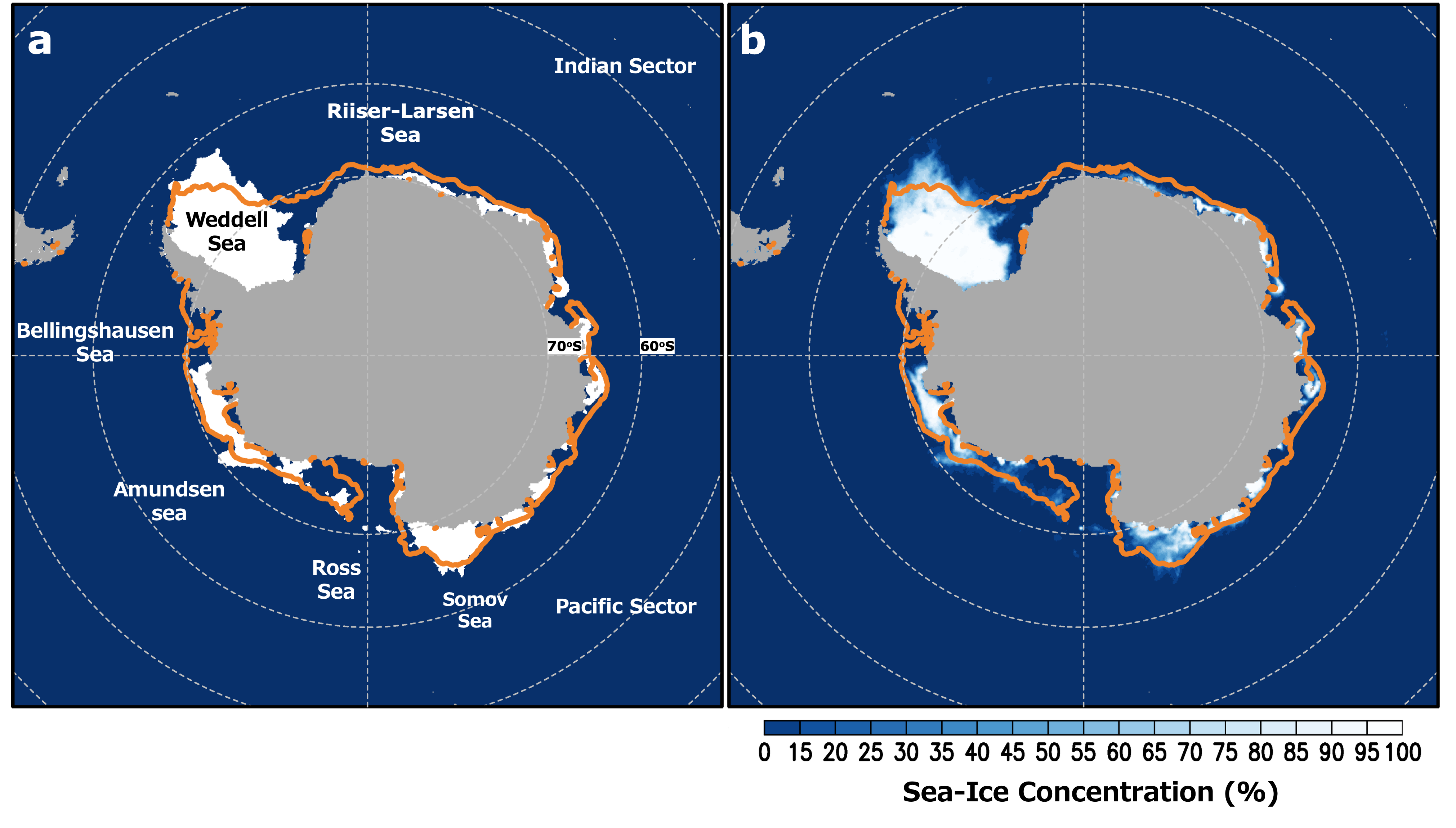
In February 2026, daily Antarctic sea-ice extent decreased steadily, remaining at a level similar to the 2010s mean until mid-February, and then reached the annual minimum on February 24 (Figure 5). The monthly mean Antarctic sea-ice extent in February 2026 was 3.01 million square kilometers. This is about 0.68 million square kilometers larger than in 2025 and close to the 2010s mean (3.07 million square kilometers) (Figure 6). Sea-ice extent was close to the 2010s mean in the Weddell and Somov Sea, while it was below the 2010s mean in most other regions (Figure 7). As Antarctic sea ice typically begins to expand after the annual minimum, continued monitoring of sea-ice conditions will be important in the coming months.
1: Sea-ice extent
For details on the calculation method of sea-ice extent, please refer to ADS . In this article, we used a five-day average.
2: NCEP-NCAR Reanalysis 1 (https://psl.noaa.gov/data/gridded/data.ncep.reanalysis.html) from Kalnay et al., The NCEP/NCAR 40-year reanalysis project, Bull. Amer. Meteor. Soc., 77, 437-470, 1996